Credits

Credits

Cesium is a JavaScript library for creating 3D globes and 2D maps in a web browser without a plugin. It uses WebGL for hardware-accerlated graphics, and is cross-platform, cross-browser, and tuned for dynamic-data visualization. Cesium is open source under the Apache 2.0 license. It is free for commercial and non-commercial use. Visit Cesium Home


jQuery EasyUI provides easy to use components for web developers, which is built on the popular jQuery core and HTML5. These make your applications suitable for today's web.


jQWidgets provides a comprehensive solution for building professional web sites and mobile apps. It is built entirely on open standards and technologies like HTML5, CSS, JavaScript and jQuery. jQWidgets enables responsive web development and helps you create apps and websites that look beautiful on desktops, tablets and smart phones. You can use jQWidgets with TypeScript, popular frameworks like Angular 2, KnockoutJS and server-side technologies like ASP.NET MVC, PHP, JSP and Node.js


Other Libraries used

jQuery Visit jQuery Home

jQuery UI Visit jQuery UI Home

Joyride Visit Joyride Home

Kinetic Visit Kinetic Home

Modernizer Visit Modernizer Home

Satellite Orbit tracked (iSat) Visit on GitHub

Gpredict Visit Gpredict Home

PredictLib Visit PredictLib Home

Special Thanks To

Steve (aka Virus) for the logo

Licence

Copyright 2012-2017 Alex Greenland

Licensed under the Apache License, Version 2.0 (the "License");
you may not use this file except in compliance with the License. You may obtain a copy of the License at

http://www.apache.org/licenses/LICENSE-2.0

Unless required by applicable law or agreed to in writing, software distributed under the License is distributed on an "AS IS" BASIS, WITHOUT WARRANTIES OR CONDITIONS OF ANY KIND, either express or implied. See the License for the specific language governing permissions and limitations under the License.

Home
View
Select Select view.

Selects the view you wish to display.

See Help for mor information
Select View
  • List View
  • Passes View
  • 3D View
  • Polar View
  • Sky View
  • Timeline View
  • Dx View
Reset Reset view.

Resets the current view to its defaults.

See Help for mor information
Satellites
Groups Select Satellite Group.

Selects the group of satellites.

See Help for mor information
Select Group
Select Select Satellites.

Selects the satellites to display and show orbits for.

See Help for mor information
Select Satellite
Display All Satellites.

Display all satellites in the current group.

See Help for mor information
Remove All Satellites.

Remove all satellites from display.

See Help for mor information
Update
Elements
Update Elements.

Update the elements for this satellite group.

See Help for more information
Settings
Options
Reset All
Options
Save
Help
Help
Tour
Contact
Community
List View
View Options
Reset Reset view.

Resets the list view to its defaults.

See Help for more information
Show
Mutual
Show Mutual.

Adds a column to the table which indicates if the satellite is visible from both your location and the mutual observer.

See Help for more information
3D View
View Options
Views Select view.

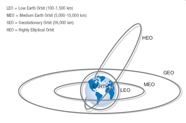
Choose from 3d, 2d or 2.5d views.

See Help for more information
Select View
  • 2D View
  • 2.5D View
  • 3D View
Provider Map Provider.

Select the provider for the globe rendering.

See Help for more information
Select Provider
  • Static Image
  • Bing maps
  • Arc Gis
Reset Reset view.

Resets the 3d view to its defaults.

See Help for more information
Black Marble
Show Black Marble.

Toggle displaying the Black Marble Image Layer.

See Help for mor information
Select Black Marble Opacity
Select Black Marble Brightness
Show Atmoshpere.

Toggle displaying the atmoshpere.

See Help for mor information
Show Skybox.

Toggle displaying the skybox.

See Help for more information
Show FrameRate.

Display the frame rate.

See Help for more information
Show Mouse Pos.

Toggle displaying the lat and lon of the mouse position.

See Help for more information
Show Terrain.

Toggle displaying terrain data

See Help for more information
Show Cities.

Toggle displaying Cities

See Help for more information
Satellite Options
Show
Mutual
Show Mutual Locations.

Show Mutual locations visible from the selected satellite.

See Help for more information
Show Satellite Labels.

Toggle displaying the name of the satellites.

See Help for more information
Show Satellite ssp.

Toggle displaying the sub satellite points for a pass.

See Help for more information
Information
Visible
Locations
Visible Locations.

Show locations visible from the selected satellite.

See Help for more information
Follow
From
Satellite
Follow Satellite.

Follows the selected satellite, looking at your location.

See Help for more information
From
Home
Follow Satellite.

Follows the selected satellite, looking from your location. This will ONLY work when the satellite is visible.

See Help for more information
Satellite
View
Satellite View.

Shows the view of the earth from the satellites perspective.

See Help for more information
Select And Fly To Satellite
Passes View
View Options
Reset
Show
Mutual
Show Mutual.

Adds a column to the passes grid indicating if the selected satellite is visible from your home location and the mutual observers location.

See Help for more information
Pass Table
Select Bottom left View
  • 3D View
  • Polar View
  • Sky View
  • Az/El View
Select Bottom Right View
  • 3D View
  • Polar View
  • Sky View
  • Az/El View
Date And Time
Show Next
24 Hours
Start Date
Select Start date
End Date
Select End date
Find
Passes
Satellite
Polar View
View Options
Reset
Show Planets

Toggle displaying planets.

See Help for mor information
Sky View
View Options
Reset
Show Planets

Toggle displaying planets.

See Help for mor information
Show City

Toggle displaying the city.

See Help for mor information
Timeline View
View Options
Reset
Show
Mutual
Show Mutual.

Displays mutal visibility in the timeline view.

See Help for more information
Zoom In

Zoom In.

See Help for mor information
Zoom Out

Zoom Out.

See Help for mor information
DX View
View Options
Reset
Debug View
View Options
Reload
Data
Cache Options
Clear

No Satellite Selected

Please select a satellite to display its information.

Date Azimuth Elevation Visibility Range Footprint Doppler Shift (Hz) Signal Loss (dB) Signal Delay (ms) Mutual Visible

General Options

Debugging

Enable Debug View

NOTE: This is only intended for developers to examine internal data from the SPM engines.


Observer Options

Home Location

Use Browser To Find Location

Selecting this option will attempt to use the browsers inbuilt Geo Location. If you do not select this option you can manually specify your location below.

Location name
Location Latitude
Location Longitude
Location Altitude

Mutual Location

Enable Mutual Observer

Selecting this option will enable certain features allowing indicating when a satellite is visible to both your location ansd a mutual observers location.

Location name
Location Latitude
Location Longitude
Location Altitude

Satellite Options

Position Calculations

Calculate Every (Seconds)

If you have a slower PC then try increasing this value to improve performance.

AoS When Above (In Degrees)

Satellite Groups

Default TLE Group

Select the satellite group to load at startup.

Auto Add From TLE Group

Automatically add all of the satellites in a group when its selected. NOTE: This will also add all of the satellites from the default group when the page is loaded.


Polar View Options

View Colours

Background Colour
Border Colour
Gradient Start
Gradient End
Grid Colour
Text Colour
Degree Text Colour
Reset Colours To Defaults

Passes View Options

Default views

The passes view has two views that can be set by default. Select the default views to be shown below. The views can be altered on the passes ribbon tab. NOTE: You will need to refresh the page for these settinsg to take effect.

Bottom Left View
Bottom Right View

3D View Options

Static Map Image

Static Map Image

Select the static map image to use in the 3D view.

Views and providers

Default View Default Provider
Use Terrain Provider

The Terrain Provider will show elevation data on the 3D view.

Satellites

Unselected Selected
Icon
Icon Size
Label Size
Label Colour

Following Options

Height Above Observer Location

Select the height above the observer location, this is in meters.

Height Above Satellite

Select the height above the satellite location, this is in meters.

Cities

Show Cities

Enable this option to show cities on the 3d view.

Font Size px

The font size for the city labels in pixels

Population Limit Million

Cities will only be displayed if their population is above or equal to this limit.

Label Colour

The label colour

Satellite Orbits Orbit Number AoS LoS Points Calc Time (ms)
Welcome to AGSatTrack - Online

Basic Concepts

Your Location. When first started the browser will ask you if the site is allowed to use your location. if you answer yes then the browser will attempt to determine your approximate location. note this is not generally that accurate. Under options->observer you can select your exact location.

Satellites are loaded from groups, these match the standard groups available on sites like celestrak. A default group is loaded at startup, unless you have changed this the 'amateur' group is loaded. To load a group select the 'Groups' dropdown from the Home ribbon menu. You can also specify the default group to load in the options, under satellites.

Once a group is loaded you need to add satellites to display. When a satellite is displayed its data is calculated. Those satellites not being displayed will not have any data calculated for them. By default all satellites in the loaded group are automatically added. You can disable this in Options->satellites.

Satellites can be 'selected', this can be done from the list viewe, Satellite Selector or generally by clicking on a satellite in any view. Once a satellite is selected more data will be displayed, generally its orbit and passes. The Satellite info pannel on the left will also show more information. If multiple satellites are selected then a drop down will appear allowing you to select the satellite to show more detailed information for.

Views

There are 7 main views available.

  • List View. This is a basic list of all satellites loaded and is updated to reflect current data. For large groups of satellites the list is paged. The page size can be set at the botom of the view.
  • 3D View. This is a rotatable, zoomable view of the earth. satellites will be displayed, along with their orbits of there are selected. if the current orbit has a pass over your location this will be shown in green on the orbit path. The imagry for the earth can be selected in the 'provider' drop down. You can follow a selected satellite either from your location or from the satellite. The 'View' option also allows for a 2D and 2.5D view.
  • Passes View. This view displays pass information for a satellite. The satellite and pass can be selected in the ribbon menu. The two bottom views can be selected in the ribbon menu. the default for these two views can be specified in the options.
  • Polar View. This displays a Polar, or radar, view.
  • Sky View. This displays a view looking South from your location. This can be handy for visual satellite observation. The horizon image can be dragged up and down if its in the way or turned off in the ribbon menu.
  • Timeline View. This will show all passes for the selectedd satellites within the next 24 hours.
  • Az/El View. This is only available in the passes view. It shows a graph of Azimuth and elevation for a selected pass.

Debug View

This must be enabled in the options. This view is primarily intended to debug issues. It shows all of the available satellites along with information about the internal calculation engine.

Initialising
Group: NONE
Following: NONE
0 Satellites Loaded

Contact

To contact me please send an email to alex AT agsattrack.com

Ok
Ok
  1. Select a Group

    This drop down contains the groups you can use. Amateur is loaded by default. Selecting another group will load the satellites from that group.

  2. Select Satellites

    Select the satellites you wish to display. Satellites in the right hand listbox will be displayed. Checking the checkbox will also display the orbit and footprint.

  3. Switch View

    Select the view to display. You can also set the ribbon bar to switch view when you click on a tab, look in the settings under views.

  4. View Tabs

    Each view has customisable options

  5. Satellite Information

    The left hand pane contains details about the selected satellite. If multiple satellites are selected then a drop down will be available to select which satellite to show data for.

  6. Program Options

    Setup Agsattrack how you like it :-)

Information

There are {tlecount} satellites loaded but none are current being displayed.

before satellites are displayed you need to add them. There are two ways to add satellites.